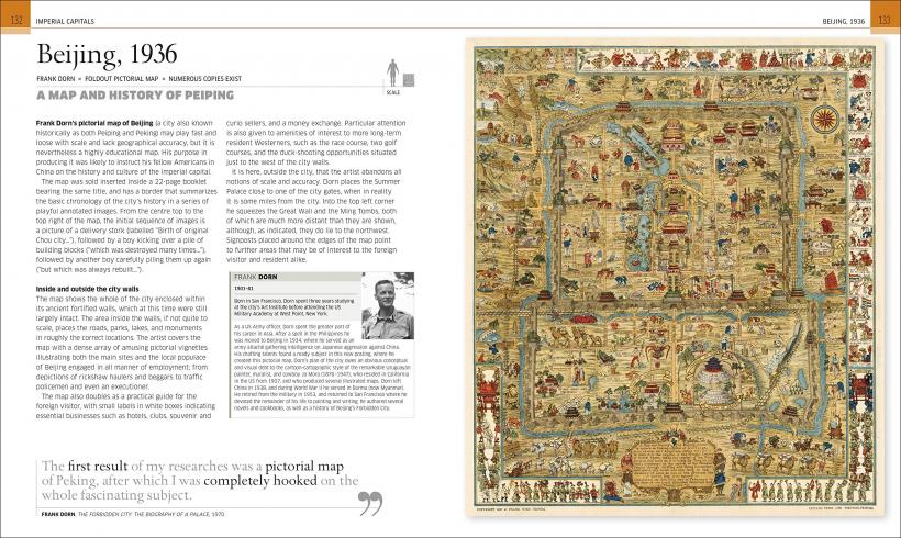
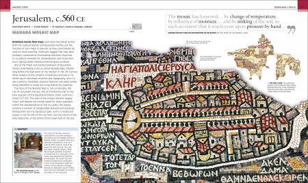
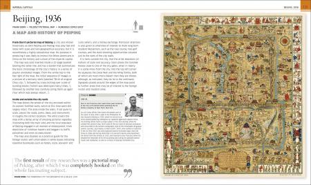
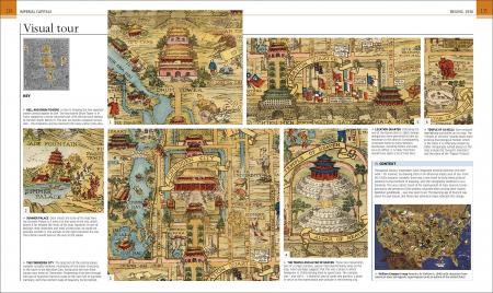
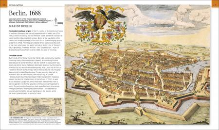
Архитектура
- Всі книги розділу
- Антологии
- Ежегодники
- Журналы
- Архитектурные конкурсы
- Архитектура Востока
- Архитектурные стили
- Атласы, энциклопедии, словари
- Высотные здания
- Города мира
- Дизайн жилых интерьеров
- Дизайн коммерческих интерьеров
- Дизайн офисов
- История архитектуры
- Кафе, бары, рестораны
- Конструкции и проектирование
- Ландшафтный дизайн, сады
- Магазины, витрины, стенды
- Материалы
- Многоквартирные дома
- Монографии. Сборники работ
- Общественные здания и пространства
- Отели и курорты
- Рисунок
- Страны мира
- Строительство, реконструкция
- Урбанизм
- Учебники. Справочники
- Философия архитектуры
- Частные дома
- Деревянные дома
- Эко архитектура
- Элементы
- Бассейны
- Камины, очаги, печи
- Колористика
- Текстиль, шторы, портьеры
- Разное
Дизайн
- Всі книги розділу
- Айдентика, логотипы
- Атласы, энциклопедии, словари
- Графический дизайн
- Дизайн в моде, фэшн дизайн
- Дизайн выставок и ивентов
- Дизайн в рекламе
- Дизайн вывесок, указателей
- Дизайн мебели
- Дизайн упаковки
- Ежегодники, Каталоги
- Журналы
- Интерактивный дизайн. Web-дизайн
- История дизайна
- Колористика
- Креатив
- Крой, вышивка, декорирование ткани
- Мир Востока
- Орнаменты
- Открытки, календари
- Печатные издания
- Постеры, иллюстрации
- Промышленный дизайн
- Рисунок
- Сборники работ
- Теория дизайна
- Типографика, Шрифты, Леттеринг
- Учебники
- Флористика, Entertaining
- Ювелирные украшения
- Разное
Искусство
- Всі книги розділу
- Антиквариат
- Антология
- Атласы, энциклопедии, словари
- Боди-арт
- Граффити, street art, urban art
- Живопись
- Малая серия книг по живописи
- История искусства
- Каталоги
- Кино
- Комиксы
- Коллекционирование
- Мир Востока
- Музеи мира
- Музыка
- Обучающие пособия
- Сборники работ
- Скульптура, Керамика
- Современное искусство
- Страны и культуры
- Теория искусства
- Ювелирные украшения
- Разное
Фото